How to use Google Maps GPS offline
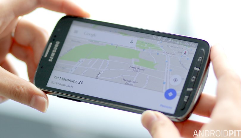

Google Maps is a great app, but it requires a constant data connection, and that's not ideal if you’re traveling outside cities, where data connections can be sparse. The good news is that there are ways to get around that. Here’s how to use Google Maps GPS offline.
- How to share directions from Google Maps for Android
- How to clear search and location history in Google Maps for Android
How to use Google Maps GPS offline
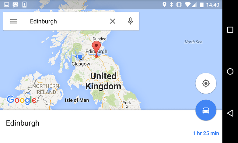
If you’re going to an unfamiliar place, you can use the Maps app to download a map for that area so you can access it offline (we’ve use a city for our demonstration because it makes for more exciting screenshots, even though you can usually count on getting a phone signal and/or Wi-Fi in a city).
There are limits to how much map data your device can store, but the Maps app will warn you if you’re trying to download half of Europe when you’re only actually interested in a hamlet.
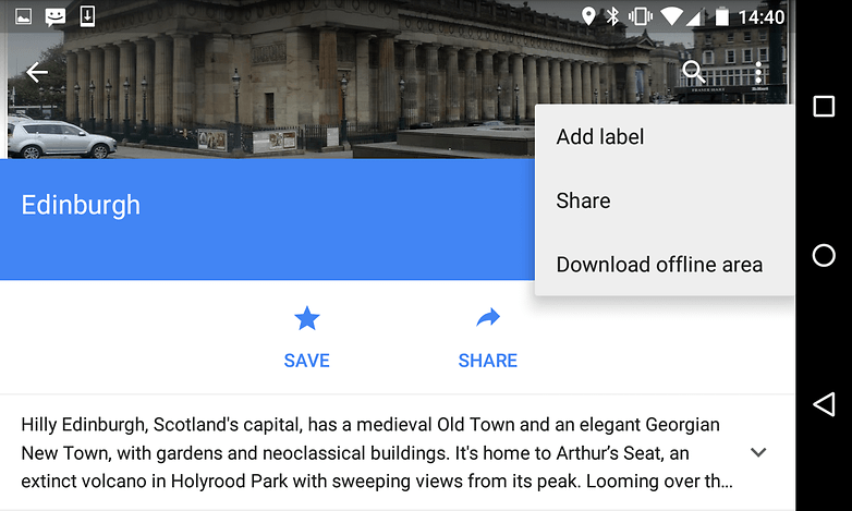
To save a map for offline reading:
- Launch the Google Maps app
- Search for the place you’re going to or that you need to map
- Tap on the name of the place
- Tap on the three-dot icon to bring up the options
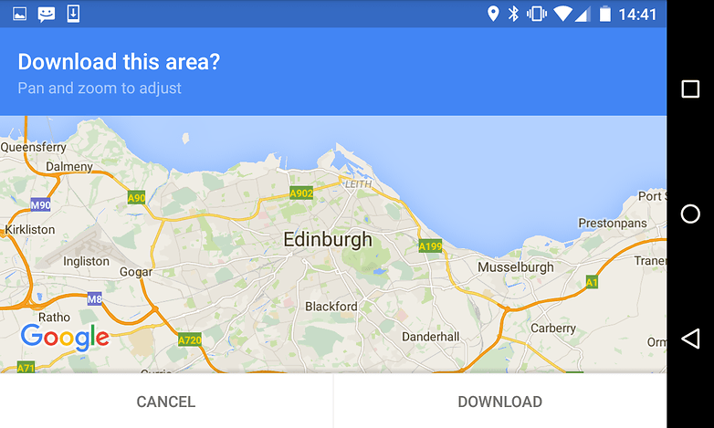
- Tap on Save Offline Map
- The app will now ask you to pan and zoom to select the area you want to download; the smaller the area the happier the app will be. If you’re trying to do too much, the app will ask you to zoom closer.
To access the map you’ve downloaded, bring out the menu drawer, tap on My Places and scroll down until you see your downloaded map or maps. The maps work just as you’d expect, although without a data connection you won’t be able to take advantage of features such as live traffic information or live public transit times.
Offline maps are stored by the Google Maps app for 30 days, then they’re automatically deleted.
How to use GPS when you can’t get Google
Offline maps are all well and good, but they’re hardly as useful as dedicated GPS apps. For the time being Google Maps doesn’t offer GPS tracking when there’s no data signal, but there are lots of Android apps that do. We’ve had good experiences with various TomTom navigation apps, but they can be pricey.
TomTom GPS Navigation Traffic is a decent app but it comes with in-app purchases, so you might want to check out a free option first. One of the best is MapFactor Navigator, which is built on the OpenStreetMap project (although there’s also a paid-for version that uses TomTom data).
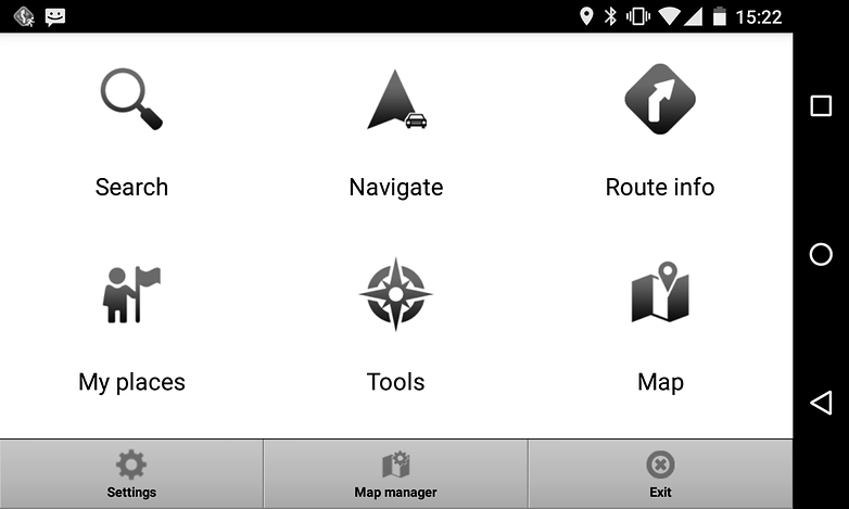
The first step after installing the app is to download the map(s) you need. There’s no point downloading the entire planet – it’d take forever and you’d run out of storage space – but since entire countries weigh in at less than half a gigabyte you don’t need oodles of room either. You can’t use the app until you’ve downloaded the data, so don’t leave this till you're rushing out the door.
Once you’ve downloaded the appropriate map data you use the app just as you’d expect: tell it where you want to go, set the appropriate mode of transport (car, bike, bus or foot; there are also options for truckers who can’t go down certain roads) and away you go. The app can automatically reroute you if you get lost or take a wrong turning, and doesn’t need to download any additional data to do so.
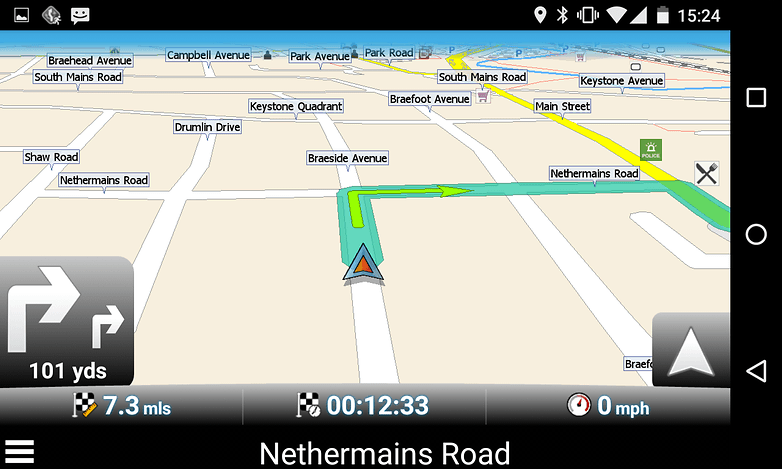
Is an app really good enough for GPS?
Yes, but there are some issues: if you don’t have a charger handy you can easily run your battery down to zero on even a fairly short trip, and of course you can lend a stand-alone GPS unit to somebody else without worrying that they’ll go into your online banking or private photo library.
And remember, if you’re using a navigation app abroad and it’s using your phone’s data connection, you could be running up a truly terrifying phone bill. We use navigation apps abroad but we make sure we either buy a data bundle in advance or just keep the phone’s cellular modem switched off.
What about you? Do you have a favorite Android GPS app, or do you stick with Google most of the time? Let us know in the comments.





Since you have to type in an area and the map size is limited to 30x30 sq/mile area - its pretty much useless for anyone living outside a city. You just can't download a map for rural America - bigger map with half the roads.
Nokia's Here is a good app to use in this case. And it is more accurate than Google maps
Try "Map Me" even has sights set out for you to pick from...
Brilliant in Marrakesh yesterday...
Gary, its rather easier to download Here and use its thorough and fully downloadable offline map capability.